Blackpool Maps and Orientation
(Blackpool, Lancashire, England, UK)
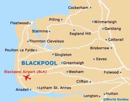
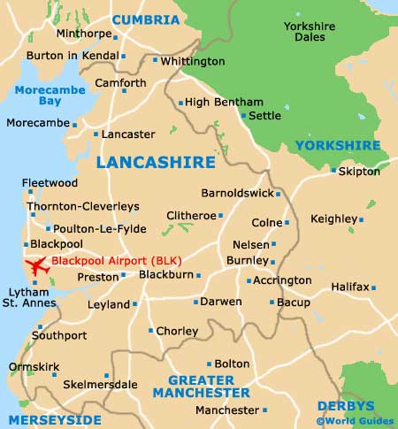
Located on the far north-western side of England in the county of Lancashire, Blackpool is close to Blackburn, Lancaster, Pemberton, Preston and Southport. Blackpool enjoys a truly legendary and impressive coastal position. With many miles of sandy beach and superb vantage points from so many different places, the town is easy to reach, being linked to the north and south by the M6, which in turn leads to the M55, the A583, the A584 and the A585.
Especially close to Blackpool is the small town of Fleetwood, which lies directly north and has a population of almost 30,000 people. Known for its historic fishing port, Fleetwood is so close to Blackpool that is often considered a suburb and part of the Greater Blackpool region. Also nearby and located along Lancashire's scenic Flyde coast are the towns of Cleveleys and Thornton, which lie approximately 6 km / 4 miles to the north.
Maps and Orientation of the Town
Other areas of interest on the outskirts of the town include Ansdell, Hambleton, Lytham, Preesail, Pilling, Singleton and Staining, amongst others.
Map of the United Kingdom

Map of Lancashire
Map of Blackpool